Ulubione (0)
Koszyk
(0)
(0)
Brak produktów
Do ustalenia
Wysyłka
0,00 zł
Razem
Produkt dodany poprawnie do Twojego koszyka
Ilość
Razem
Ilość produktów w Twoim koszyku: 0.
Jest 1 produkt w Twoim koszyku.
Razem produkty:
Dostawa:
Do ustalenia
Razem
Fototapety na wymiar
-
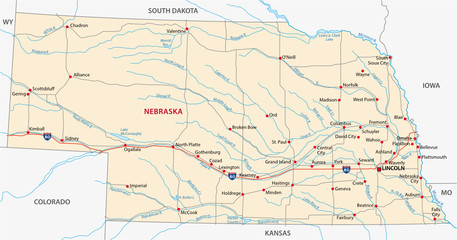 nebraska road map
 -
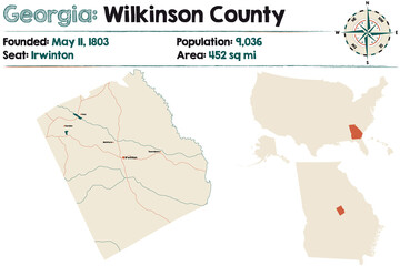 Large and detailed map of Wilkinson county in Georgia, USA.
 -
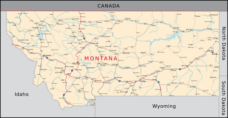 Montana
 -
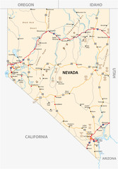 Nevada road map with interstate US highways and federal highways
 -
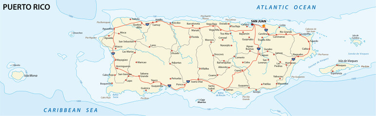 puerto rico road map
 -
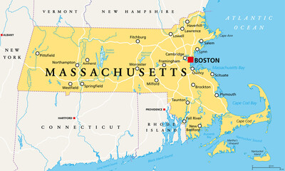 Massachusetts, political map with capital Boston. Commonwealth of Massachusetts, MA. Most populous state in the New England region of the United States. The Bay State. English. Illustration. Vector.
 -
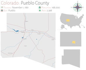 Large and detailed map of Pueblo county in Colorado, USA.
 -
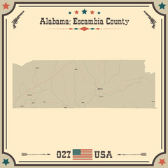 Large and accurate map of Escambia county, Alabama, USA with vintage colors.
 -
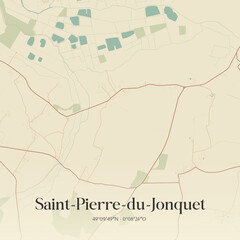 Vintage map of Saint-Pierre-du-Jonquet, France.
 -
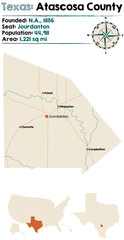 Detailed map of Atascosa county in Texas, USA
 -
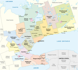 Map of the Golden Horseshoe metropolitan area around the western end of Lake Ontario, Ontario, Canada
 -
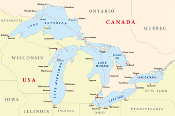 map of great lakes
 -
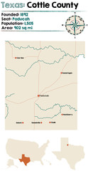 Detailed map of Cottle county in Texas, USA.
 -
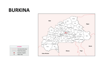 Burkina Faso Map. State map of Burkina Faso. Administrative map of Burkina Faso with state and capital in white color.
 -
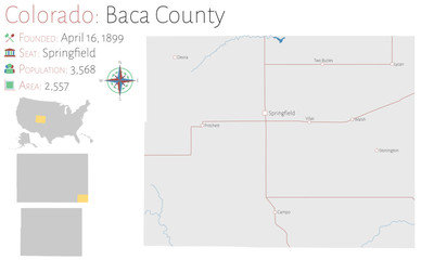 Large and detailed map of Baca county in Colorado, USA
 -
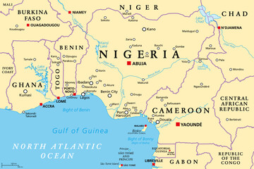 Nigeria and West Africa countries on the Gulf of Guinea, political map. Ghana, Togo, Benin, Nigeria, Cameroon, Equatorial Guinea, and Sao Tome And Principe, with borders, capitals and largest cities.
 -
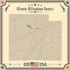 Large and accurate map of Effingham County, Illinois, USA with vintage colors.
 -
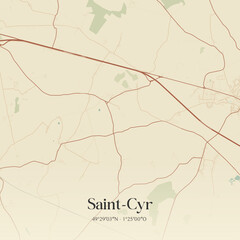 Vintage map of Saint-Cyr, France.
 -
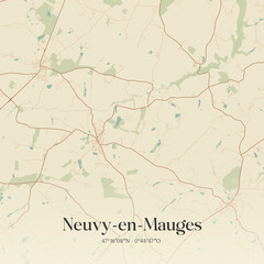 Vintage map of Neuvy-en-Mauges, France.
 -
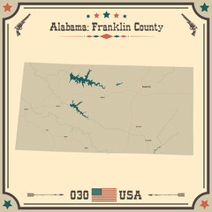 Large and accurate map of Franklin county, Alabama, USA with vintage colors.
 -
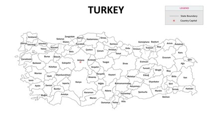 Turkey Map. State and State map of Turkey. Administrative map of Turkey with States and boundaries in white color. Turkey map with neighbouring countries' names.
 -
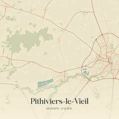 Vintage map of Pithiviers-le-Vieil, France.
 -
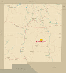 Road map of New Mexico US American federal state. Editable highly detailed transportation map of New Mexico with highways and interstate roads, rivers and cities vector illustration
 -
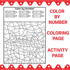 Color By Number Coloring & Activity Page
 -
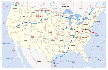 Fictional map of North America with isobars and weather fronts. Meteorological forecast.
 -
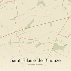 Vintage map of Saint-Hilaire-de-Briouze, France.
 -
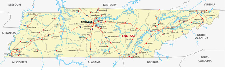 tennessee road map
 -
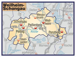 Landkreis Weilheim-Schongau Variante7