Ulubione (0)
Koszyk
(0)
(0)
Brak produktów
Do ustalenia
Wysyłka
0,00 zł
Razem
Produkt dodany poprawnie do Twojego koszyka
Ilość
Razem
Ilość produktów w Twoim koszyku: 0.
Jest 1 produkt w Twoim koszyku.
Razem produkty:
Dostawa:
Do ustalenia
Razem
Fototapety na wymiar
-
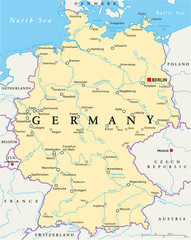 Germany Political Map
 -
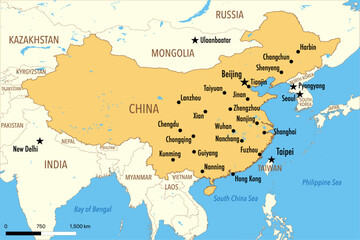 Vector Map of China with Major Cities and Neighboring Countries – Editable Illustration
 -
 Austria, political map, with the capital Vienna, most important cities and national borders
 -
 Belarus Map - Detailed Vector Illustration
 -
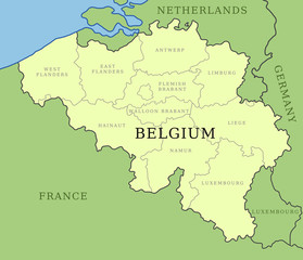 Belgium provinces map
 -
 Political map of Ukraine with borders of the regions. template for your design
 -
 administrative and political map of the state of Saarland
 -
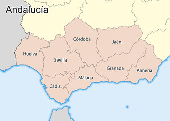 Vector map of the spanish autonomous community of Andalusia
 -
 Venezuela
 -
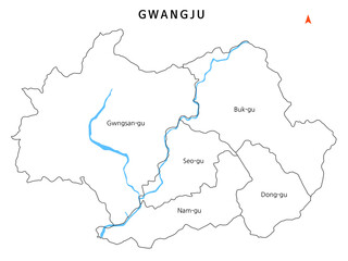 대한민국 광주광역시 자치구 경계선이 있는 지도
 -
 paraiba administrative map
 -
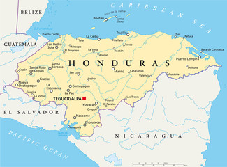 Honduras political map with capital Tegucigalpa, with national borders, most important cities, rivers and lakes. Illustration with English labeling and scaling. Vector.
 -
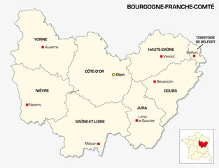 New French administrative region Bourgogne-Franche Comte
 -
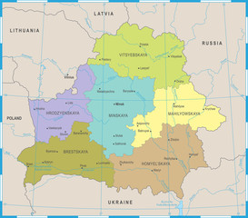 Belarus Map - Detailed Vector Illustration
 -
 Arunachal Pradesh vector map
 -
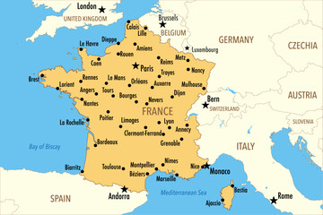 Vector Map of France with Major Cities and Neighboring Countries – Infographic Illustration
 -
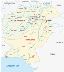 pakistan-afghanistan map
 -
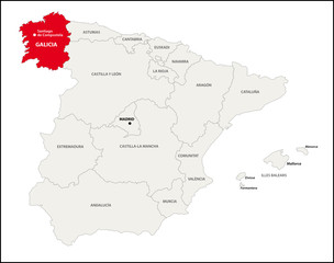 Autonome Region Galicien, Spanien
 -
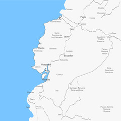 Detailed vector map Ecuador.
 -
 Piedmont region in northwest Italy, political map. Second largest Italian region with capital Turin, bordering France, Switzerland, and the regions Aosta Valley, Lombardy, Emilia-Romagna, and Liguria.
 -
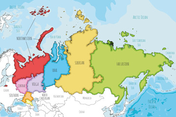 Vector illustrated map of Russia with regions or federal districts and administrative divisions, and neighbouring countries. Editable and clearly labeled layers.
 -
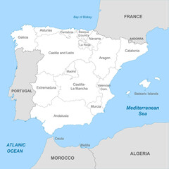
 Map of Spain
 -
 paraiba road map
 -
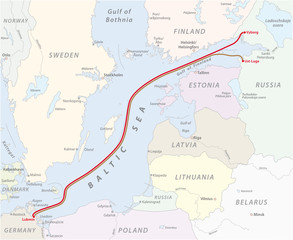 Map of the Baltic Sea gas pipeline between Russia and Germany
 -
 Trentino-Südtirol
 -
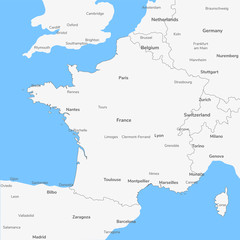 Detailed vector map France.
 -
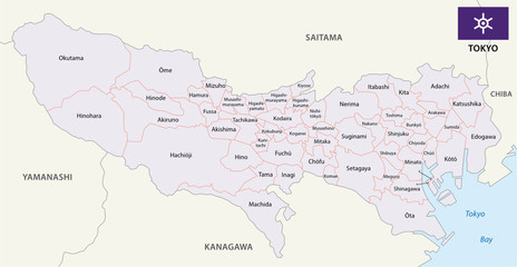 tokyo prefecture administrative map with flag
 -
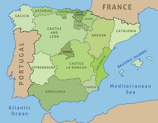
 Political map of Spain with borders with borders of regions