Ulubione (0)
Koszyk
(0)
(0)
Brak produktów
Do ustalenia
Wysyłka
0,00 zł
Razem
Produkt dodany poprawnie do Twojego koszyka
Ilość
Razem
Ilość produktów w Twoim koszyku: 0.
Jest 1 produkt w Twoim koszyku.
Razem produkty:
Dostawa:
Do ustalenia
Razem
Fototapety na wymiar
-
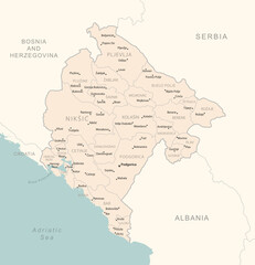 Montenegro - detailed map with administrative divisions country.
 -
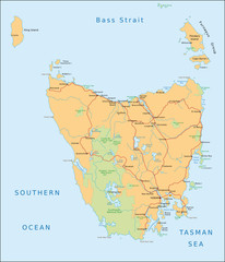 Tasmanien
 -
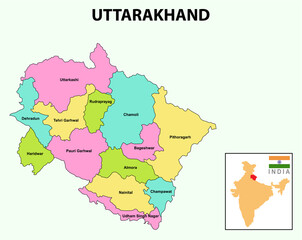 Uttarakhand Map. Showing State boundary and district boundary of Uttarakhand map.
 -
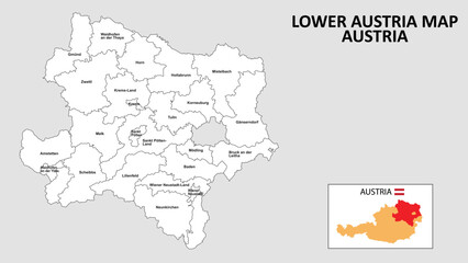 Lower Austria Map. State and district map of Lower Austria. Administrative map of Lower Austria with district and capital in white color.
 -
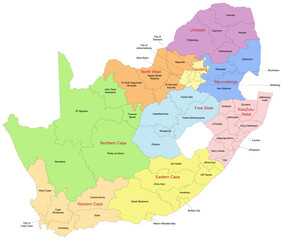 Carte d'Afrique du Sud avec représentation des divisions administratives par districts et provinces - Textes vectorisés et non vectorisés sur calques séparés
 -
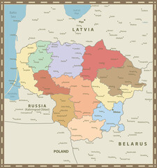 Lithuania Map Vintage Colors
 -
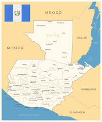 Guatemala - detailed map with administrative divisions and country flag. Vector illustration
 -
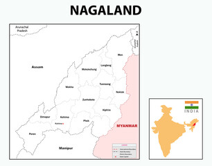 Nagaland map. Outline map of Nagaland. Nagaland administrative and political map. Nagaland map with neighbouring countries and border in white colour.
 -
 Romania - detailed map with administrative divisions and country flag. Vector illustration
 -
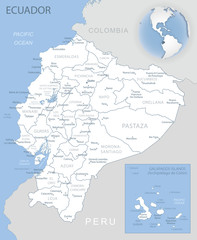 Blue-gray detailed map of Ecuador administrative divisions and location on the globe.
 -
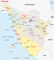 tuscany administrative map
 -
 Austria - detailed map with administrative divisions and country flag. Vector illustration
 -
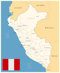 Peru - detailed map with administrative divisions and country flag. Vector illustration
 -
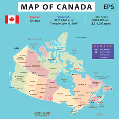 Geography politics map of countries. map of america, map of canada, map of argentina, map of brazil, map of colombia,
 -
 Afghanistan Full City Names And Map Vector illustration
 -
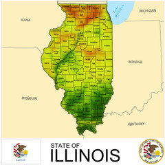 Illinois USA counties name location map background
 -
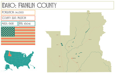 Large and detailed map of Franklin County in Idaho USA.
 -
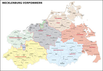 Mecklenburg-Vorpommern Landkreise
 -
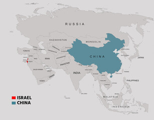 China and Israel Highlighted on Asia Map Showing Borders and Locations
 -
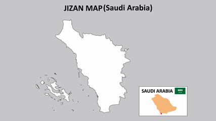 Jizan Map.Jizan Map Saudi Arabia with white background and line map.
 -
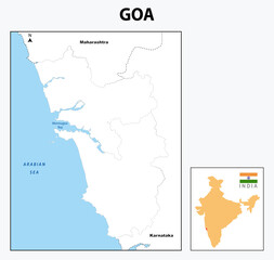 Goa map. Goa map with neighboring countries and border in outline.
 -
 전라북도 완주군 행정동 윤곽선 지도
 -
 administrative vector map of belgium regions, provinces and districts
 -
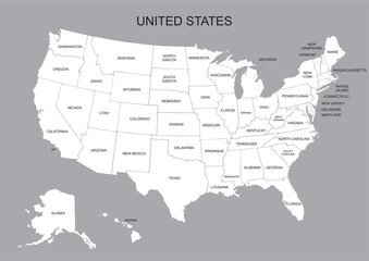 USA map white color - United State of America vector illustration map with all state names - Poster of administrative map of USA, States and geographical borders.
 -
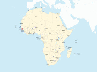 Detailed national location map of GUINEA-BISSAU within the great continent of Africa
 -
 Administrative and political vector map of the Indian state of Goa
 -
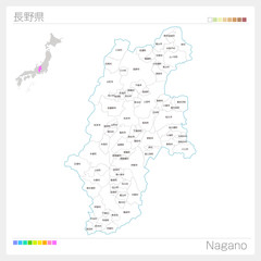 長野県の地図(市町村・区分け)
 -
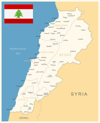 Lebanon - detailed map with administrative divisions and country flag. Vector illustration