Ulubione (0)
Koszyk
(0)
(0)
Brak produktów
Do ustalenia
Wysyłka
0,00 zł
Razem
Produkt dodany poprawnie do Twojego koszyka
Ilość
Razem
Ilość produktów w Twoim koszyku: 0.
Jest 1 produkt w Twoim koszyku.
Razem produkty:
Dostawa:
Do ustalenia
Razem
Fototapety na wymiar
-
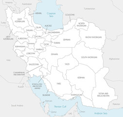 Vector map of Iran with provinces and administrative divisions, and neighbouring countries. Editable and clearly labeled layers.
 -
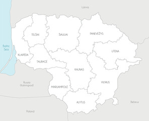 Vector regional map of Lithuania with counties and administrative divisions, and neighbouring countries and territories. Editable and clearly labeled layers.
 -
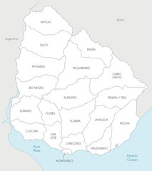 Vector map of Uruguay with departments and administrative divisions, and neighbouring countries. Editable and clearly labeled layers.
 -
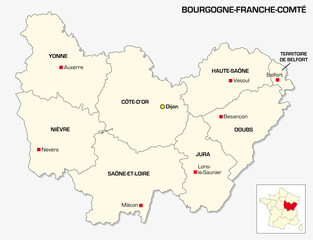 New French administrative region Bourgogne-Franche Comte
 -
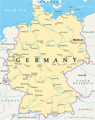 Germany Political Map
 -
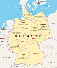 Germany, officially the Federal Republic of Germany, political map. Country in Central Europe with capital Berlin. Map of the 16 constituent states with borders, capitals, and neighbor countries.
 -
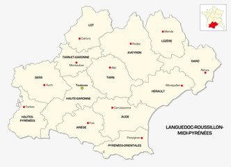 New French administrative region Languedoc-Roussillon-Midi-Pyrenees
 -
 administrative and political map of the state of Saarland
 -
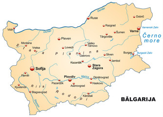 Map of Bulgaria with capitals
 -
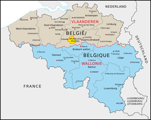 Belgien Verwaltung
 -
 Political map of Ukraine with borders of the regions. template for your design
 -
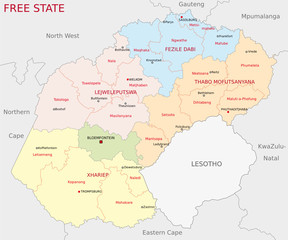 free state administrative map
 -
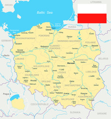 Polska - mapa i flaga ilustracja
 -
 Belarus Map - Detailed Vector Illustration
 -
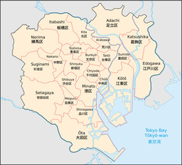 Tokio, Bezirke
 -
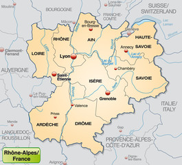 Umgebungskarte von Rhrône-Alpes mit Grenzen in Pastelorange
 -
 Austria, political map, with the capital Vienna, most important cities and national borders
 -
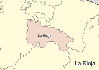 Vector map of the spanish autonomous community of La Rioja
 -
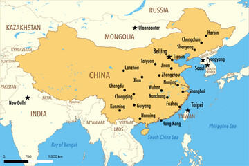 Vector Map of China with Major Cities and Neighboring Countries – Editable Illustration
 -
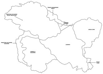 Detailed Political Map of Greater Kashmir Region with Labels Including Ladakh Jammu Aksai Chin Gilgit Baltistan and Siachen Glacier with Directional Arrows for Educational Reference and Vector Atlas
 -
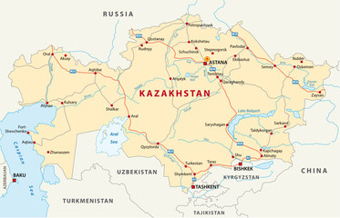 kazakhstan road map
 -
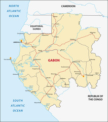 Gabon
Gabon -
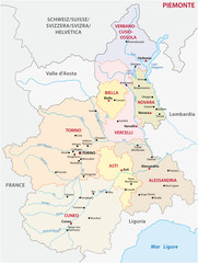
 Piedmont region in northwest Italy, political map. Second largest Italian region with capital Turin, bordering France, Switzerland, and the regions Aosta Valley, Lombardy, Emilia-Romagna, and Liguria.
 -
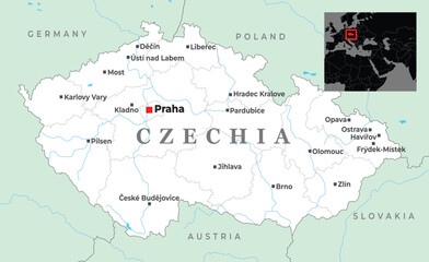 Map of Czechia showing key cities like Prague, Brno, Ostrava, and its borders with Germany, Poland, Slovakia, and Austria, placed in Central Europe
 -
 piedmont administrative map
 -
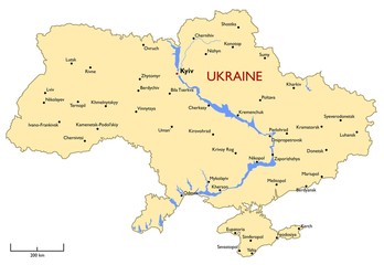 Ukraine map
 -
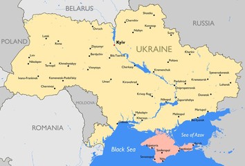 Ukraine map
 -
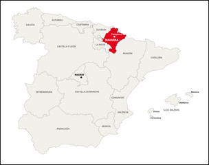 Autonome Region Navarra, Spanien