Ulubione (0)
Koszyk
(0)
(0)
Brak produktów
Do ustalenia
Wysyłka
0,00 zł
Razem
Produkt dodany poprawnie do Twojego koszyka
Ilość
Razem
Ilość produktów w Twoim koszyku: 0.
Jest 1 produkt w Twoim koszyku.
Razem produkty:
Dostawa:
Do ustalenia
Razem
Fototapety na wymiar
-
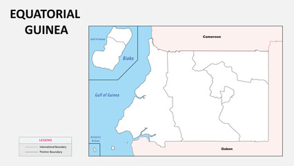
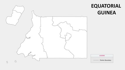 Equatorial Guinea map. Country map of Equatorial Guinea. Administrative map of Equatorial Guinea with Countries names in outline.
 -
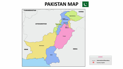 Pakistan Map. Colorful Pakistana Map with neighboring countries names and borders.
 -
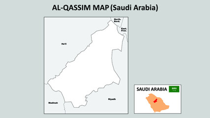 Al-Qassim Map. Political map of Al-Qassim. Al-Qassim Map of Saudi Arabia with neighboring countries and borders.
 -
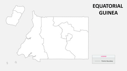 Equatorial Guinea map. Country map of Equatorial Guinea. Administrative map of Equatorial Guinea with Countries names in outline.
 -
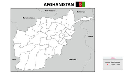 Afghanistan Map. State and district map of Afghanistan. Political map of Afghanistan with outline and black and white design.
 -
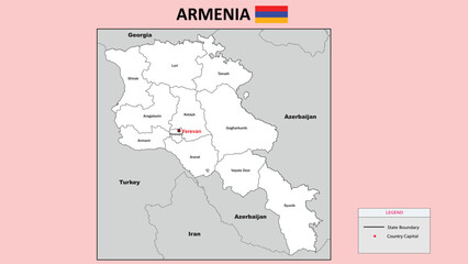 Armenia Map. State and district map of Armenia. Administrative map of Armenia with district and capital in white color.
 -
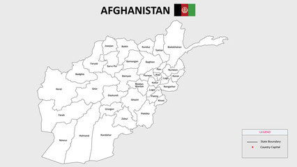 Afghanistan Map. State and district map of Afghanistan. Administrative map of Afghanistan with district and capital in white color.
 -
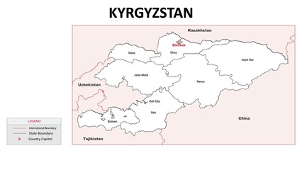 Kyrgyzstan Map. State and district map of KYRGYZSTAN. Administrative map of KYRGYZSTAN with district and capital in white color.
 -
 전라북도 김제시 행정동 윤곽선 지도
 -
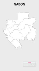 Gabon map. Country map of Gabon. Administrative map of Gabon with Countries names in outline.
 -
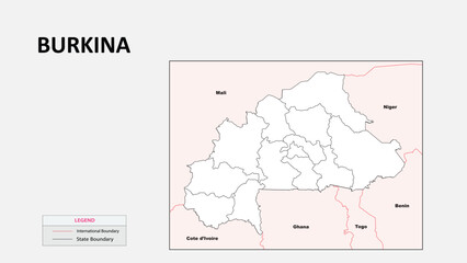
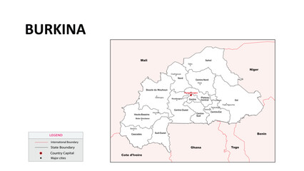 Burkina Faso Map. State map of Burkina Faso. Administrative map of Burkina Faso with state and capital in white color.
 -
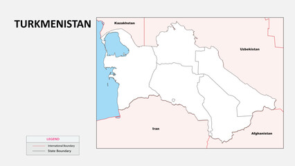 Turkmenistan Map. Political map of Turkmenistan with State border in outline. Political map of Turkmenistan with outline and neighbouring countries.
 -
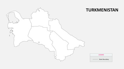 Turkmenistan Map. State map of Turkmenistan. Administrative map of Turkmenistan with States names in outline.
 -
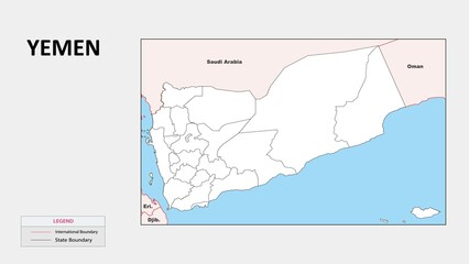 Yemen Map. Political map of Yemen with State border in outline. Political map of Yemen with outline and neighbouring countries.
 -
 Brazil map button
 -
 Burkina Faso Map. Political map of Burkina Faso with state border in outline. Political map of Burkina Faso with outline and neighbouring countries.
 -
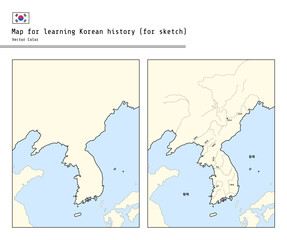 This illustration is a map for sketching for Korean history education. It can be colored by each era.
 -
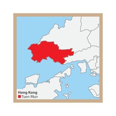 tuen mun state map
 -
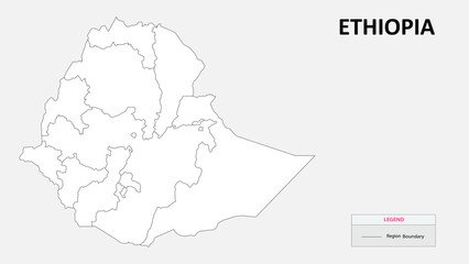 Ethiopia map. Country map of Ethiopia. Administrative map of Ethiopia with Countries names in outline.
 -
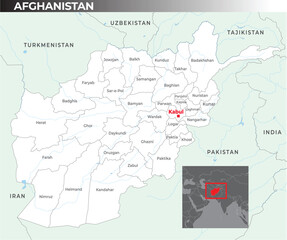 Afghanistan map with capital Kabul, most important cities and national bordersAfghanistan map with capital Kabul, most important cities and national borders
 -
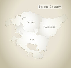 Basque Country map, administrative division with names, old paper background vector
 -
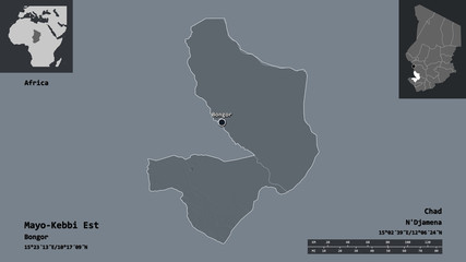 Mayo-Kebbi Est, region of Chad,. Previews. Administrative
 -
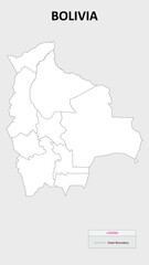 Bolivia Map. State map of Bolivia. Administrative map of Bolivia with states names in outline.
 -
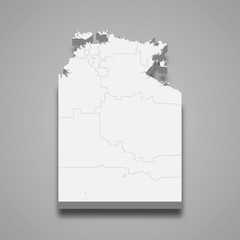 northern territory 3d map state of Australia Template for your design
 -
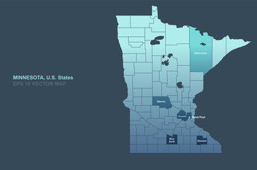 minnesota map. vector map of minnesota, U.S. States.
 -
 Equatorial Guinea map. Political map of Equatorial Guinea with Country border in outline. Political map of Equatorial Guinea with outline and neighbouring countries.
 -
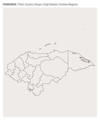 Honduras plain country map. High Details. Outline Regions style. Shape of Honduras. Vector illustration.
 -
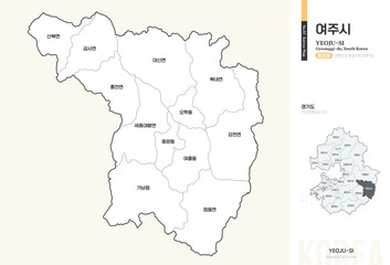 경기도 여주시 행정동 윤곽선 지도