Ulubione (0)
Koszyk
(0)
(0)
Brak produktów
Do ustalenia
Wysyłka
0,00 zł
Razem
Produkt dodany poprawnie do Twojego koszyka
Ilość
Razem
Ilość produktów w Twoim koszyku: 0.
Jest 1 produkt w Twoim koszyku.
Razem produkty:
Dostawa:
Do ustalenia
Razem
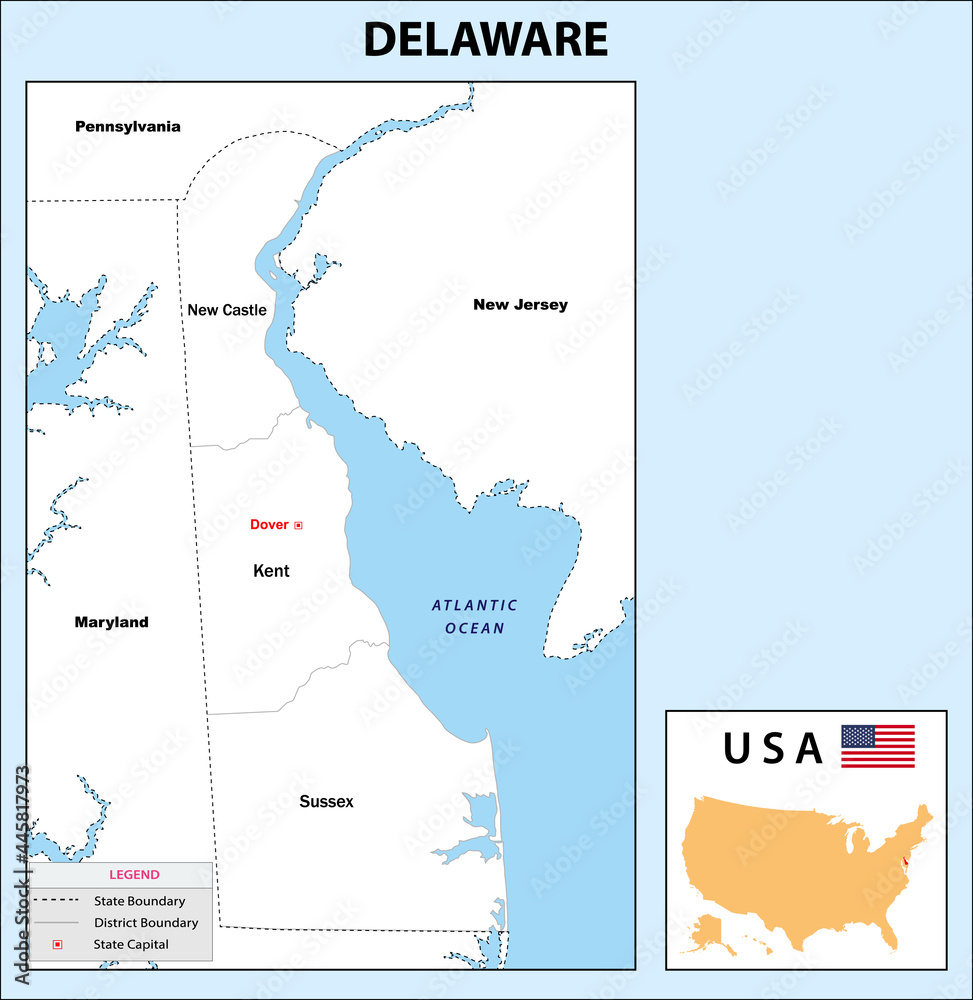
Fototapeta Delaware Map. State and district map of Delaware. Administrative and political map of Delaware with neighboring countries and border in white color.
Ładowanie fotografii...
+
-
© awesome arttGeneruj link do kompozycji
JESTEŚ PROJEKTANTEM WNĘTRZ?
Zapraszamy do naszego Programu Partnerskiego.
Napisz do nas i poznaj szczegóły! [email protected]
Rodzaj wydruku
Wybierz materiał - Chcesz go najpierw zobaczyć? Zamów wzornik
Laminat
Kliknij w pola poniżej i wpisz wymiar ściany + 2% zapasu
Szerokość [cm]
max:
Wysokość [cm]
max:
Kadr
Standard
Kadr
Montaż
MONTAŻ
Termin realizacji
Efekty


Cena przed rabatem: 0zł
Rabat: 0zł
Cena: 0PLN
+ Dodaj do ulubionych
Opis zdjęcia