-

Ulubione (0)
Koszyk
(0)
(0)
Brak produktów
Do ustalenia
Wysyłka
0,00 zł
Razem
Produkt dodany poprawnie do Twojego koszyka
Ilość
Razem
Ilość produktów w Twoim koszyku: 0.
Jest 1 produkt w Twoim koszyku.
Razem produkty:
Dostawa:
Do ustalenia
Razem
Fototapety na wymiar
-
 Landkarte von Tirol mit Hauptstädten
 -
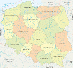
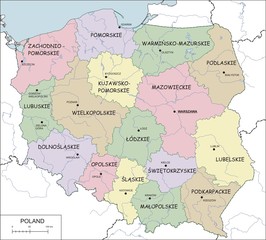 Mapa konturowa Polski z województwami, rzekami i jeziorami
 -
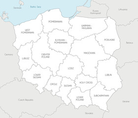 Vector map of Poland with provinces and administrative divisions, and neighbouring countries and territories. Editable and clearly labeled layers.
 -
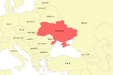 ウクライナを中心とした周辺国の地図
 -
 Balkanstaaten in grau (beschriftet) - Vektor
 -
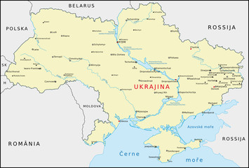 Ukraine
 -
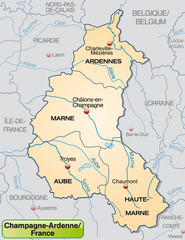 Umgebungskarte von Champagne-Ardenne mit Departements
 -
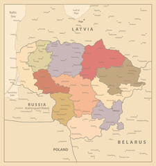 Lithuania Vintage Map
 -
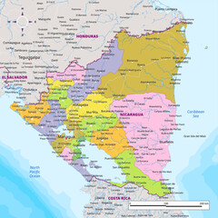 Detailed political map of Nicaragua
 -
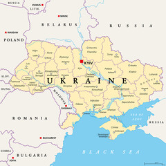 Ukraine, administrative divisions, political map. Country and unitary state in Eastern Europe with capital Kyiv, also called Kiev. Country subdivision with administrative centers. Illustration. Vector
 -
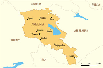 Vector Map of Armenia with Major Cities and Neighboring Countries – Editable Illustration
 -
 paraiba road map
 -
 Wektorowa mapa Polski podziału administracyjnego vol.5
 -
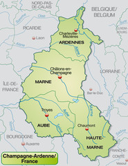 Umgebungskarte von Champagne-Ardenne mit Departements
 -
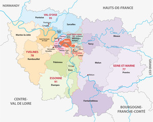 new ile de france administrative and political vector map
 -
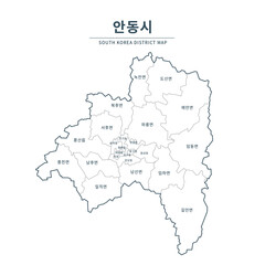 Andong map. Map of South Korea with Major Cities, Clean Line Design on White Background.
 -
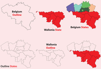 Wallonia map vector of Belgium, Wallonia line map, Wallonia with city map, Wallonia outline map
 -
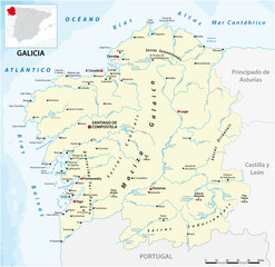 vector map of the Spanish autonomous communities of galicia
 -
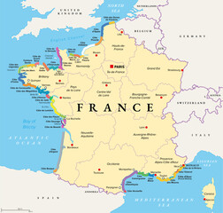 The coasts of France, political map. Most important coasts and beaches in France. Commonly used and popular names of the stretches in tourism. Map with the regions of France and most important cities.
 -
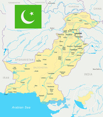 Pakistan - map and flag illustration
 -
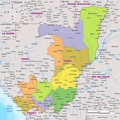 Political map of Republic of the Congo
 -
 Tajikistan - detailed map with administrative divisions and country flag.
 -
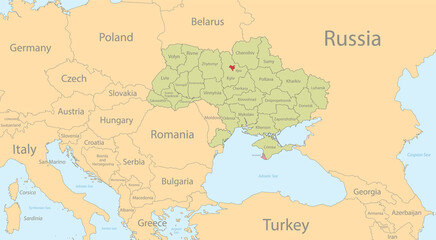 Ukraine map with individual regions and capital city, with individual neighboring states with names, classic color map vector
 -
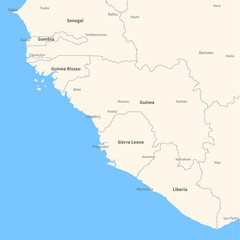 Detailed vector map Guinea.
 -
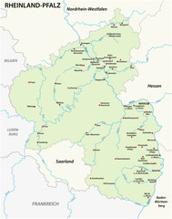 Mapa stanu Nadrenia-Palatynat mapa w języku niemieckim
 -
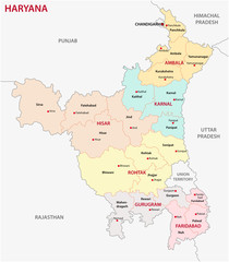 Haryana administrative and political map, India
 -
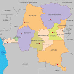 Democratic Republic of Congo map
 -
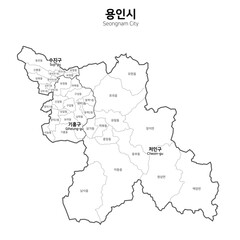 대한민국 용인시 지도