Ulubione (0)
Koszyk
(0)
(0)
Brak produktów
Do ustalenia
Wysyłka
0,00 zł
Razem
Produkt dodany poprawnie do Twojego koszyka
Ilość
Razem
Ilość produktów w Twoim koszyku: 0.
Jest 1 produkt w Twoim koszyku.
Razem produkty:
Dostawa:
Do ustalenia
Razem
Fototapety na wymiar
-
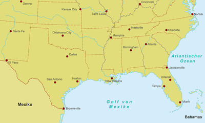 Südküste der USA - Städte (Orange)
 -
 Karte von Nigeria - Orange (detailliert)
 -
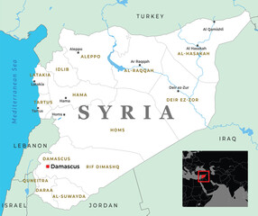 A detailed map of Syria, showcasing its geographical location, major cities, and neighboring countries
 -
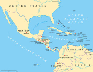 Mapa polityczna Ameryki Środkowej ze stolicami i granicami. W połowie szerokości regionu obu Ameryk. Meksyk, Ameryka Środkowa, Karaiby i północna Ameryka Południowa. Ilustracja. Etykietowanie w języku angielskim. Wektor.
 -
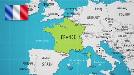 France on the World Map with the country's national flag flying.
 -
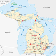 michigan road map
 -
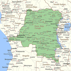 Dem. Rep. Congo-World-Countries-VectorMap-A
 -
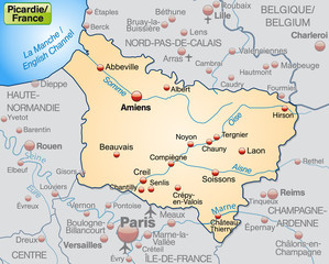 Picardie als Übersichtskarte in Pastelorange
 -
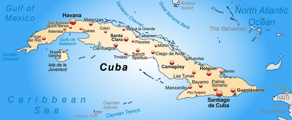 Umgebungskarte von Kuba
 -
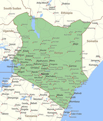 Kenya-World-Countries-VectorMap-A
 -
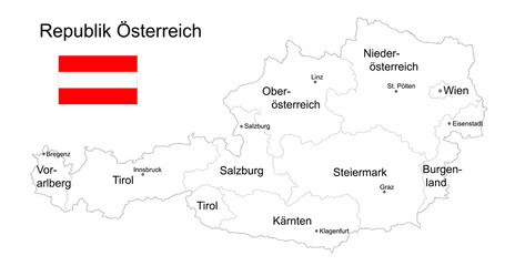
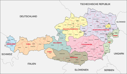
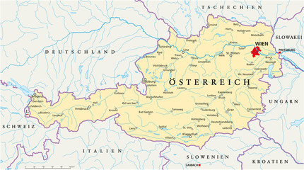 Österreich Landkarte ( deutsch )
 -
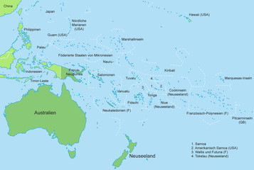 Ozeanien - Karte in Grün
 -
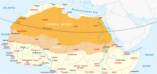 Vector map of the Sahara desert and Sahel zone
 -
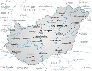 Umgebungskarte von Ungarn
 -
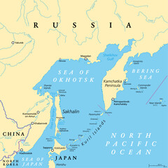 Sea of Okhotsk, political map. A marginal sea of the North Pacific Ocean, located between the Kamchatka Peninsula, the Kuril Islands, Hokkaido, Sakhalin, and a stretch of the eastern Siberian coast.
 -
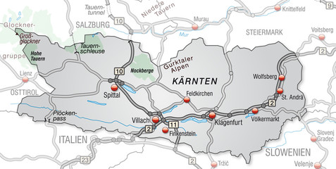 Verkehrskarte von Kärnten und Umgebung
 -
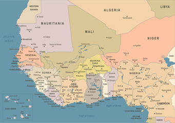 West Africa Map - Vintage Vector Illustration
 -
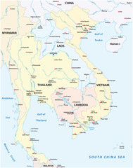 Map of the states of Southeast Asia
 -
 Landkarte Republik Österreich zum ausmalen, mit Flagge, Bundesländer, Städte und Hauptstädte, Vektor Illustration isoliert auf weißem Hintergrund
 -
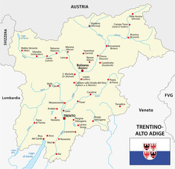 trentino alto adige map with flag
 -
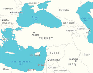 Political map of Turkey and Syria, highlighting the surrounding neighboring countries
 -
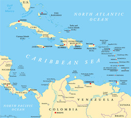 Caribbean political map with capitals, national borders, important cities, rivers and lakes. English labeling and scaling. Illustration.
 -
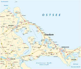 Road vector map of the Baltic Sea island of Usedom in German language, Germany, Poland
 -
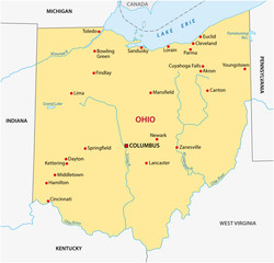 simple ohio state map
 -
 Österreich, Bundesland, Bezirk
 -
 Brazil Map - Vector Illustration
 -
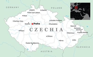 Map of Czechia showing key cities like Prague, Brno, Ostrava, and its borders with Germany, Poland, Slovakia, and Austria, placed in Central Europe
 -
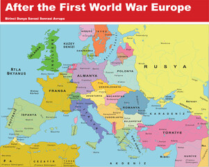 After the first world War Europe