Ulubione (0)
Koszyk
(0)
(0)
Brak produktów
Do ustalenia
Wysyłka
0,00 zł
Razem
Produkt dodany poprawnie do Twojego koszyka
Ilość
Razem
Ilość produktów w Twoim koszyku: 0.
Jest 1 produkt w Twoim koszyku.
Razem produkty:
Dostawa:
Do ustalenia
Razem
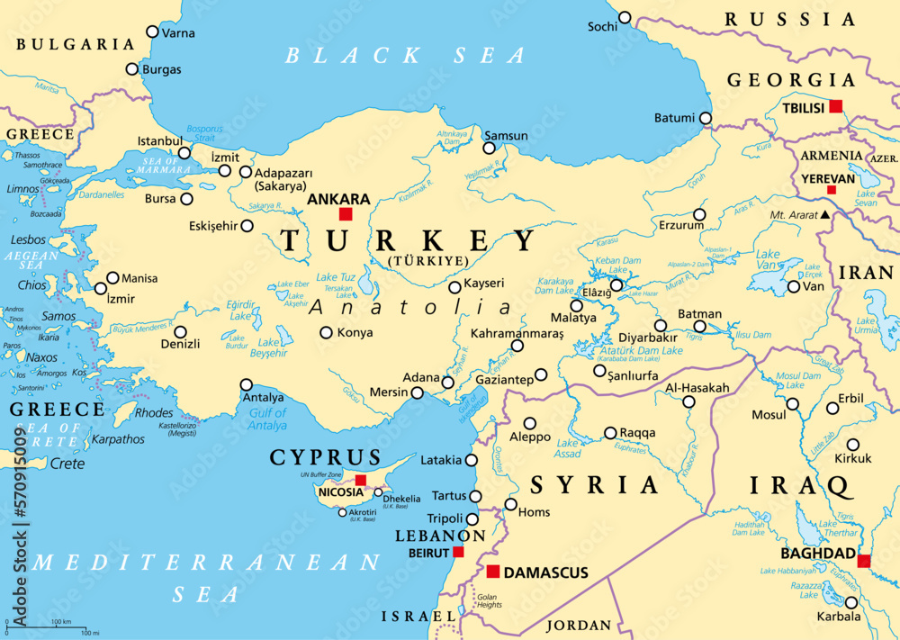
Fototapeta Turkey and Syria region, political map. Geographic area of the peninsula Anatolia, with neighbouring and surrounding countries. Map with capitals, largest cities, and most important rivers and lakes.
Ładowanie fotografii...
+
-
© Peter Hermes FurianGeneruj link do kompozycji
JESTEŚ PROJEKTANTEM WNĘTRZ?
Zapraszamy do naszego Programu Partnerskiego.
Napisz do nas i poznaj szczegóły! [email protected]
Rodzaj wydruku
Wybierz materiał - Chcesz go najpierw zobaczyć? Zamów wzornik
Laminat
Kliknij w pola poniżej i wpisz wymiar ściany + 2% zapasu
Szerokość [cm]
max:
Wysokość [cm]
max:
Kadr
Standard
Kadr
Montaż
MONTAŻ
Termin realizacji
Efekty


Cena przed rabatem: 0zł
Rabat: 0zł
Cena: 0PLN
+ Dodaj do ulubionych
Opis zdjęcia