Ulubione (0)
Koszyk
(0)
(0)
Brak produktów
Do ustalenia
Wysyłka
0,00 zł
Razem
Produkt dodany poprawnie do Twojego koszyka
Ilość
Razem
Ilość produktów w Twoim koszyku: 0.
Jest 1 produkt w Twoim koszyku.
Razem produkty:
Dostawa:
Do ustalenia
Razem
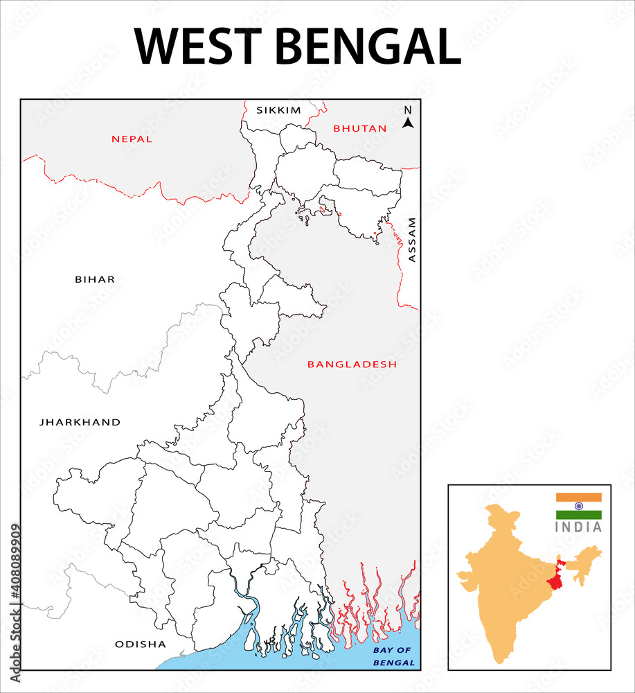
Fototapeta West Bengal map. Political and administrative map of West Bengal with districts name. Showing International and State boundary and district boundary of Assam. Illustration of districts Kolkata map.
Ładowanie fotografii...
+
-
© awesome arttGeneruj link do kompozycji
JESTEŚ PROJEKTANTEM WNĘTRZ?
Zapraszamy do naszego Programu Partnerskiego.
Napisz do nas i poznaj szczegóły! biuro@ulala.com.pl
Rodzaj wydruku
Wybierz materiał - Chcesz go najpierw zobaczyć? Zamów wzornik
Laminat
Kliknij w pola poniżej i wpisz wymiar ściany + 2% zapasu
Szerokość [cm]
max:
Wysokość [cm]
max:
Kadr
Standard
Kadr
Montaż
MONTAŻ
Termin realizacji
Efekty


Cena przed rabatem: 0zł
Rabat: 0zł
Cena: 0PLN
+ Dodaj do ulubionych
Opis zdjęcia


